A Master Plan for the Central Districts of Los Santos
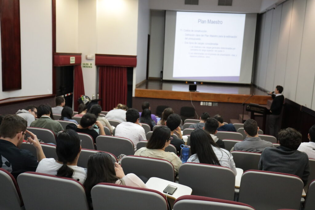
The Universidad Latina’s School of Architecture, the School of Public Relations, and the School of Biology have launched a pilot project in May 2019 to investigate “Villages and the Territory as a Commons”.
This marks the first time that research and extension activities are conducted collaboratively by faculty members of the Creative Campus. The goal is to create an improvement plan for “Zona de Los Santos”, renowned for its high-quality coffee. The “Zone of Saints” comprises Dota, León Cortés, and Tarrazú cantons. Initially, this project will focus on the central districts, particularly Dota and Tarrazú villages.
Diagnosis and Prototype Stages to Support Local Communities
The project is engaging stakeholders from various communities such as informal trade, rural tourism, and environment sectors. An initial direct relationship has been established with 35 people from these different sectors, providing them with workshops on commons governance and Fair Trade. In the long run, this will create chain effects and benefit many more of those living in villages indirectly. The project is also being conducted alongside the Environmental and Cultural Management Units of the Municipalities of Dota, Tarrazú, and León Cortés, among other involved actors.
Establishing a Sustainable Landscape as Heritage
The Municipalities of the geographic area “de Los Santos”, together with the Costa Rican Tourism Institute and the Ministry of Culture, seek to identify and make visible their territory’s identity—both internally to articulate different initiatives and externally to establish a clear line for what type of tourism should be promoted nationally and internationally. This poses an architectural and urban challenge for the School of Architecture: establishing lines of work that maintain or rescue the place’s identity, from its cultural heritage reflected in older constructions to its relationship with new—and inevitable—”styles” exogenous architectural features brought by development.
This project proposes identifying variables and indicators for developing rural territory. At the architectural level, these would allow creating a Master Plan of the central districts of Dota, Tarrazú, and León Cortés. At the Public Relations level, it could generate a proposal for territorial marketing.
Collaboration with the School of Biology to Manage Endemic Species
The project will progress in stages, following LabGov’s protocol guidelines:
Diagnosis: A previous diagnostic phase has been carried out to detect the community groups with which it will work.
Prototype: On the part of the School of Architecture, in this phase, the design and construction of three modular interventions will be carried out, which will be exposing results of the diagnostic and research phases. The School of Public Relations will support micro and small enterprises, especially family management, to formalize the image of the company and the strategic positioning of the product.
Master Plan: Once the diagnostic and Prototype phases with the communities are underway, a Master Plan will be established for the central districts of the Cantons of the Los Santos Zone with the support of local governments. Some architectural and urban-landscape design interventions will be established to be developed employing preliminary projects.
Community Workshops: A series of community workshops and training will be carried out to monitor the project, focusing on the identification of more problems, as well as for training on issues related to the management of common goods, the Social Solidarity Economy, and the landscape as heritage.
Enhancing Commons Through Community Governance
The project is currently in its prototyping stage and will finish by the end of this year. From next year, more courses from the career, graduation projects, and collaboration with the School of Biology will be included to survey and manage endemic species of these landscapes, especially with a regenerative approach. We believe Costa Rica can contribute greatly to an approach that views territory as a common good to counteract the negative impacts of misguided human “development”. Villages and cities can act as catalysts for proper resource management and enhance their commons through wise community governance.
Baton Rouge, the capital of Louisiana with approximately 800,000 residents, is a city that is spatially stratified by race and income. Some describe it as a tale of “two cities” with higher quality housing, amenities and transportation in white areas and a lack of these amenities in black areas. Many of the city’s social and economic challenges are concentrated along the Plank Road corridor, one of the most blighted areas in all of Baton Rouge. The corridor is bordered by mostly commercial land uses, with residential uses in the intersecting side streets and extending for several blocks in either direction. Its four mile length is populated by a mixture of struggling or abandoned businesses, vacant lots and dilapidated buildings. Though a few sections of this commercial road have managed to remain viable, it still faces difficult social and economic challenges given the extent of the existing blight, the high number of violent crimes, and the widespread impoverishment in this area. However, the area also serves as a significant anchor for the neighborhoods that surround it and thus presents an opportunity for inclusive urban revitalization using the co-city approach.
The Co-City project will start by focusing on the Plank Road corridor, working with the East Baton Rouge Redevelopment Authority (EBRRA). The EBRRA has an ambitious plan to revitalize the Plank Road corridor primarily through transit-oriented projects. This is, in part, due to the fact that the area around Plank Road has the highest concentration of zero car households and the second highest public transit ridership. LabGov and the Marron Institute have proposed to use the co-city approach as an entry point into the EBRRA’s comprehensive planning process. This approach would carefully guide the EBRRA through the co-city cycle – cheap talking, mapping, practicing, prototyping, testing, and modeling – used successfully in other cities. The first phase of the project will complete the cycle on a neighborhood scale before implementing the it on a broader scale and wider geographical area.
One of the core aims of the co-city approach is to promote and encourage community engagement in the planning process, which will help to ensure that whatever plan is adopted, doesn’t further or deepen the social inequalities that already exist. On the contrary, involving the community in the planning process, which the co-city method requires and facilitates, is focused on helping the various stakeholders involved in the revitalization effort to lessen the existing inequalities and to enhance the participation of underrepresented social groups. By focusing on prototyping a neighborhood scale co-governance project, such as a Neighborhood Improvement District or a Community Land Bank, the Co-City methodology will, it is hoped, ensure that the project outcome is clearly centered on the inhabitants of the district, the various stakeholders and their varying needs.
The Co-City approach, which has been applied in a variety of cities throughout the world, including Amsterdam, Bologna, Turin, New York, Sao Paolo, and San Jose, is based on a flexible but structured open source methodology, which centers on the “Co- City cycle.” This cycle is intended to create an environment conducive for participants and stakeholders to arrive at locally adaptive, experimental and co-produced institutions, policies or practices.
The first phase of the cycle, Cheap Talk, involves face-to-face, informal and pressures- free communication among key local actors (experts, practitioners, activists, residents) to activate the community of stakeholders that will be involved in the collaborative project. These discussions or sessions are organized in informal settings with significant outreach done in the local community, often through anchor organizations.
The second phase, Mapping, involves understanding the characteristics of the urban or neighborhood context through surveys and exploratory interviews, fieldwork activities, and ethnographic work. The goal in this phase to select an area of focus and begin to design and prototype the kinds of tools and processes necessary for the experimentation or collaborative project. This phase it is sometimes necessary to create a digital platform as a tool for disseminating information and engaging various communities and stakeholders.
The third phase, Practicing, is designed to identify and create possible synergies and alignment between projects and relevant actors. At heart of this phase are co-working sessions with identified actors who are willing to participate in putting ideas into practice. This phase might culminate in a collaboration day or collaboration camp that takes the form of placemaking events—i.e., micro-regeneration interventions using vacant or available land or structure such as the creation of a neighborhood community garden, for example— to prepare the actions for start of the co-design process.
In the next phase, Prototyping, participants and policymakers (local officials) reflect on the mapping and practicing phases and begin to extract the specific characteristics and needs of the community that will be served. It is in this phase that the specific policy, legal, or institutional mechanism is co-designed to solve the issues and problems identified in the previous phases.
In the Testing phase, the prototype is tested and evaluated through implementation, monitoring, and assessment. Both qualitative and quantitative metrics are employed to assess whether implementation is consistent with the design principles, objectives and outcomes identified in earlier stages. This phase is often performed working with one or more knowledge/academic partners to design appropriate indicators and metrics to capture the desired outcomes and impacts from the project.
The final phase, Modeling, focuses on adapting and tailoring the prototype and nesting it within the legal and institutional framework of the city or local government. This phase is realized through the study of relevant legal laws, regulations and administrative acts and through dialogue with civil servants and policy makers. This is an experimental phase involving perhaps the suspension of previous regulatory rules, the altering of bureaucratic processes, and the drafting of new policies which might also have a sunset clause and then a re-evaluation period. It can also involve the establishment of external or internal offices or support infrastructure in the city to support the new policies.
The Co-City methodology, and specifically the cycle described above, will be adapted to the particular features and circumstances of the Plank Road project. In order for the project to be successful, it will be essential for the team organized by LabGov/Marron Institute to build trust and confidence within the Baton Rouge community generally and the Plank Road community specifically. As such, this phase of the project will largely be devoted to creating feedback mechanisms and assurances among the community that we are attempting to facilitate development in accordance with their specific desires and needs, and not to impose “solutions” on them. Implementation of the co-city methodology in Baton Rouge is expected to begin in the fall of 2019, be carried out by a combined task force jointly appointed by LabGov and the Marron Institute, and take approximately three years to complete.
A Research and Development Program at The Universidad Latina of Costa Rica
This project is part of the Research and Development program, which seeks to develop initiatives with communities and local governments that allow for the execution of real projects that combine academic, professional, and civic engagement aspects. The projects seek to give instructors and students study materials and assignments that are directly relevant to the environment. Finally, we advocate that the findings of this program’s research be supported by institutions and delivered to relevant organizations and local governments.
Participating in this project are the academic sector, represented by the School of Architecture of the Universidad Latina; the public sector, represented by the Ministry of Housing and Human Settlements; the private sector, represented by the Council of Real Estate Developers; and finally, social innovators and civil society organisations such as the Integral Development Associations and the neighbourhood committees, as well as the La Mitad Más Uno collective.
Starting from Cheap Talking
The project will apply the guidelines proposed by the Co-City Protocol, starting from the stage of Cheap Talking.
This specific stage will be divided into two phases, the first aimed at getting to know the potential project users as current residents of the area. It is critical to start with those who will be directly impacted by the project, to understand their expectations and needs, and to gather as much information as possible about what the area is currently like and how it works. For this process to be successful, it will be necessary for local groups, such as development associations and encounter groups, to collaborate.
To follow, the second phase will be an approach with potential users—that is, to carry out a study of the target market. This part will be set up with the help of the private sector, which will share methods and strategies for studying the market.
From mapping to practicing
Similarly, the subsequent stages of mapping and practice will allow us to become more familiar with the area in which we will intervene. This will follow the urban design guidelines that are co-created at the academy level through the intervention of professors, experts in various topics such as landscaping, legislation in the urban field, planning principles, and the design of residential and mixed use buildings.
Ready to prototype and test
Lastly, the prototyping, testing, and modelling stages will mostly take place in workshops where all stakeholders can take part and where the La Mitad Más Uno collective can help guide the process.
This entails proposing sustainable collective governance strategies, such as involving users from the project’s inception; designing for a pooling economy, that is, not only project buildings but the logic of the neighborhood experience; implementing tech justice — for example, using open and transparent mechanisms and digital instruments for the management of project data — all of this through experimentalism and an enabling state, that is, a step-by-step approach.
International and Regional Impact
This project is framed within the research area “Architectural projects for the city, the landscape, and the territory. Urban planning, territorial planning and environmental assessment”, and coherently with the research lines of: Social Cohesion, Access, Equality and Preservation, Mitigation and Restoration, established in the Framework Document for Research of the School of Architecture of the Universidad Latina, in accordance with the Sustainable Development Goals promoted by the United Nations.
Through this project, we open the doors to an international opportunity for research and collaboration in urban design methodology. This will allow to project the Latin University of Costa Rica as the first academic institution in Latin America to launch this innovative Research and Development (Extension) program, which guarantees in the School of Architecture the execution of social and public projects according to the protocols of collaboration of the LabGov. The execution of this program promotes the design of projects with a strong commitment to national, governmental and non-governmental institutions as well as other academies in the world.
Impact on Students and Faculty
On the academic side, the courses in urban design will be the source of projects. This will be given under the guidance of the course teacher and the coordinators of the Research and Extension areas. The students involved, within the framework of this project, must propose a 360-degree solution to the urban problems of an area of the Greater Metropolitan Area of interest to the Ministry of Housing and Human Settlements.
The goal of compiling its process from the beginning is to share the results with governmental and private actors, as well as to share the experience in the framework of collaboration with the international network of LabGov, both through articles published in the Urban Media Lab, or in other international publications. Participation in this type of project allows the student to deepen the methodological theme of the projects he/she carries out, projecting him/her as a complete professional in the working world, having developed soft public relations skills, leadership, team coordination, fund management, and critical thinking, as well as highlighting the experience of the international LabGov research network, publications, and collaboration with NGOs, public institutions, and the private sector.
Project hypothesis
It is possible to design a new Social Housing solution within the framework of an urban regeneration plan that integrates the design of commons, applies the transect and megablocks, and reflects the new urban values of compactness, participation, 24/7 pedestrian-friendly, mixed use, and self-sufficiency (consumption and production: energy, information, goods, and services).
Location
The project implementation area is located in the center of the capital, San José, in the south area between the Sabana Metropolitan Park and the Pacific Railway Station, in Víquez Square, developing along a stretch of the railway line in a desolate area of particular abandonment. This is also due to the fact that originally it was an area for industrial use that no longer works as such, which is why the residential areas of the south of San José have developed mostly to meet the need for workers’ residences. Although the blocks of small wooden houses are characteristic of an era and a social class, the abandonment has strongly affected this sector, causing deterioration of buildings, insecurity, and poor investment in public infrastructure.
Objectives of the project
General
Propose a Social Housing design within the framework of an urban regeneration plan that integrates the design of commons taking advantage of land management instruments and international experiences in social housing.
Specific
Create a novel proposal to address access to decent housing for vulnerable populations (elderly, young people, people with disabilities, among others), while avoiding the discrimination caused by real estate projects aimed at a single target market and thus responding to a new vision of the city, as proposed in the New Urban Agenda presented at Habitat III in Quito in 2016;
Design a plan for urban renewal that includes the design of common goods as essential infrastructure and applies the new urban values: compactness, citizen participation, 24/7 city, pedestrian-friendly, mixed use, self-sufficiency (in consumption and production of energy, information, goods, and services);
Propose a strategy for buildings to offer a percentage of units for social housing, even if they are designed for the middle class. This is to reduce discrimination and integrate users at all social levels into the urban fabric.
“Where we are able to identify a network of urban commons, or some degree of polycentricism in the governance of urban resources, we begin to see the transformation of the city into a commons—a collaborative space—supported and enabled by the state.”
The article “Ostrom in the City: Design Principles for the Urban Commons” by Sheila Foster, Washington, and Christian Iaione, published in The Nature of Cities, on 20 August 2017, investigates how designing the city as a commons can help in addressing urgent urban issues such as urban poverty, gentrification, climate change, and migration, among others. Authors take reference from Elinor Ostrom’s groundbreaking research about collaborative management of common pool resources, or commons, for economic and environmental sustainability adapting the Ostrom design principle to the urban context with the aim of rethinking the governance of cities and the management of their resources. Urban commons are different from natural resources and more traditional commons in important ways, so the adaptation of Ostrom’s theories to the urban context implied an extensive research. The study at the basis of the article surveyed 100+ cities around the world to extract from these examples a set of design principles that resulted distinctively different from those offered by Elinor Ostrom but kept the potentiality of paving the way towards a transition to more fair, inclusive, sustainable, resilient futures given existing patterns of urbanization and the contested nature of urban resources.